


Neuchatel, by Susan Dodds
Geography of Kansas
S. L. Stover
November 24, 1986
Neuchatel
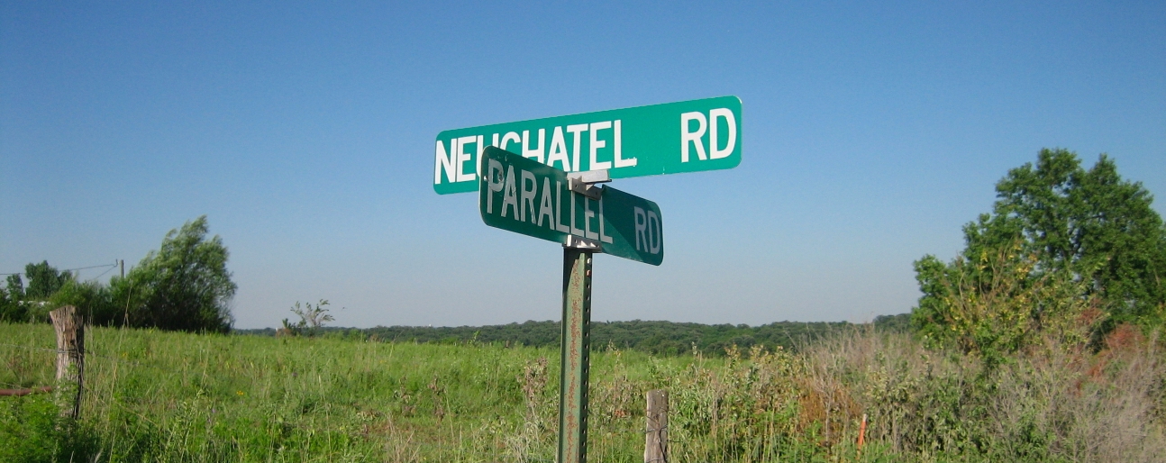
Photo N. Junod - 2010)
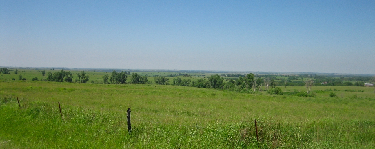
Neuchâtel is located in the hills of northeastern Kansas. Thick wooded lines border French Creek, as it skirts the south and west of the community of Neuchâtel.
The famous "parallel" road runs along the south side of Neuchatel Township and is still used by many cars. This (unpaved) road is now officially listed as No. 752 in Pottwatomie County and represents the dividing line between this county and Nemaha county.
The region of Neuchatel is a favorite place for (sports) hunters because it is full of quail, pheasants, deer, bobcat, raccoons, squirrels, doves and coyotes.
This area is part of the Kansas ice zone and many pieces of red, brown-red, and purple quartzite rocks left by glaciers are found in the pastures, fields and woods of the community of Neuchatel.
Neuchatel Township consists mainly of pastures with a few fields of sorghum, corn and soybeans: most of the farms in this area are diversified, both in livestock and in cereal cultivation. Farmers apply an arid zone approach, with some irrigation practice when French Creek and artificial ponds are available.
Among the animals bred are cattle, pigs, and some sheep. About fifty percent of the current farmers in the Township of Neuchatel hold other non-farm jobs in order to survive in the current economic situation.
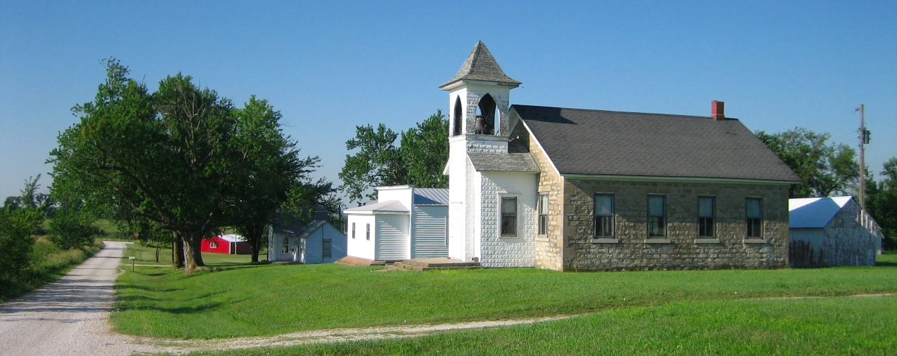
The township of Neuchatel now consists of a community hall, a school, a church (destroyed by lightning in 1994) and a cemetery. The community is made up of farms a few miles apart, contrasting with the many houses that made up the community in the 1800s. Many houses were deserted, remained vacant, dreaming of the past, the time when Neuchatel was alive and lived the American dream of conquering the West.
Neuchatel – 1856
At its discovery, the meadows of Neuchatel were little covered, the growth of grass sparse. The grass grew in isolated tufts. The constant winds over the meadow blew the soil, leaving the tufts of grass much higher than the rest of the soil.
The map from Whitman et Searl of Eastern Kansas dating from 1856, shows the location of several first historic towns and villages, but none in the Neuchâtel region. This map was the first exact source used after Kansas became a territory in 1854.
The map shows the Pottawatomie Indian Reserve south of the Neuchatel region. The only community northwest of the Neuchatel region is Marysville. The map shows that Marysville had a post office at that time.
The north of the map area does not include any cities between Neuchatel and the Nebraska Territory border. To the east the Kickapoo Indian Reserve fixes the area between Neuchatel and the area around the Missouri River at Atchison.
To the west of the Neuchatel area in 1854, there were more meadows that extended to the Blue River Valley, with no cities on the map.
On the Whitman and Searl map, Neuchatel is not listed, nor are all the notes made about settlers in this area. The government completed topographical surveys of this area in the summer of 1857.
(Photo N. Junod - 2010)
Neuchatel – the settlers
Kansas is a new territory when the first recorded settlers began claiming land in the Neuchatel area. Ezra and Steve Lot, who arrived from New York State, settled in the area in 1856.
Charles and Ami (Bach) Bonjour (Charles Adolphe and Ami Eugene Bonjour) arrived in this locality in May 1857, just after the government surveyors completed their official surveys of the territory.
The Bonjour brothers arrived in the United States from Switzerland in 1852, first settled in western Indiana before settling near French Creek in northern Kansas. They were the first French speakers to arrive in the Neuchatel region. These early settlers then recruited other French-speaking Swiss settlers. Thus, in July 1857, their brother Frédéric H. Bonjour (Frédéric Henri Bonjour), his wife Julia (Julie Adèle Simon) and L. August Zurcher (Louis Auguste Zürcher) took land claims in the Township which was called Neuchatel .
Fred and Julia Bonjour had the first white child born in the community of Neuchatel, September 21, 1857.
Ami, Charles and Gustave Bonjour and L. August Zurcher rented their lands to the government the first year and cut the hay to the scythe. L. Auguste Zurcher leaves the region of Neuchatel in 1860 after enlisting in the 4th U.S. Cavalry Regiment, to fight in the civil war. He returned to Neuchatel in the spring of 1867 after marrying Mary Dodds (whose husband William was killed in the Civil War) in Indiana. They were accompanied by his two sons, Milton and Newton Dodds. (Newton was the great-great-grandfather of Susan Dodds, the author of this report).
Many later Swiss settlers were close relatives of the first settlers of Neuchatel. Some Swiss settlers immigrated directly from Swiss cantons (mainly from Neuchâtel) and others came to Neuchatel after living in other states of the United States.
This region has also attracted settlers from other countries and regions of the United States. Henry Labbe and his family immigrated from France to Wisconsin in 1856. With Auguste Seigneur, they staked and claimed land in Neuchatel in 1866.
A popular figure in the history of Neuchatel was Peter Dockler, a medical doctor. Native of France and had practiced medicine in Africa before coming to the United States, first in the Eastern United States and Neuchatel in 1862.
A group of Belgians, who first settled in Wisconsin, subsequently settled in the Neuchâtel region. Other settlers came from other parts of the United States including Ohio, Illinois, Indiana and West Virginia.
The inhabitants of the region of Neuchâtel chose this region to settle because of its abundant water supply and fertile soil. Farmers grew corn and wheat. The first livestock consisted of raising cows, pigs and oxen. The first team of horses was seen in Neuchatel around 1860.
Early settlers lived in dugouts and cellars until they could build frame houses. The colony was noted for use of old-fashioned fences. The goods and supplies for the community were transported from the towns of Leavenworth and Atchison. Many settlers were later traders who either built their businesses in the city of Neuchatel or operated it from their farm.
The brothers Lot and L. August Zurcher were noticed for having dug a furrow from their lands from Neuchatel to the colony of America City (about nine miles to the east) and planting poplar cuttings so that others could find their way in this vast meadow.
Another thing to note is that Charles Bonjour bought the territory's second organ in 1877 and his home became a gathering place for local youth. It is also noted in the history of Neuchatel that the settlers felt the earthquake of 1868.
Neuchatel – the township
(Photo N. Junod - 2010)
The settlers who settled in Neuchatel are not strictly farmers. Many of them had trades that were helpful to others in the development of the area. Carpentry, cabinetmaker, and shoemaker are just some of the professions of the people who colonized the Neuchatel region.
Neuchatel township was developed by these talented people.
Here is a description of Neuchatel from March 1, 1878 :
Neuchatel is a small trading point on the southern line of Nemaha County, the seat of a large French colony, which has a beautiful church, controlled by Presbyterians - and Catholics will build a church north of Neuchatel this summer. There is also a school made of beautiful stone.
The companies of the place are the following ones :
Cooper : Dulac-Baptiste
General commodities : F. H. Bonjour & Co
Doctor : Dr A. Henry
Saloon : F. H. Bonjour
Steam mill : Mill Co. Neuchâtel
(From an old newspaper about Kansas' "historical accounts").
The Swiss settlers from Neuchatel were busy establishing a school for the community. Due to lack of funds, a subscription list was distributed in the community to raise funds for this school and a teacher.
The school was taught at home until a log house was built in the fall of 1868.
The school site was transferred to the present location in Neuchatel in 1871. This stone structure located on District # 5, integrated a common school system for the counties of Nemaha and Pottawatomie, until it closed during the winter of 1951.
Alfred Bonjour (Alfred Louis Bonjour) sent an application to establish a post office to the United States Government in early 1864. The post office was established on August 8, 1864, and at that time the city of Neuchatel was was officially named in honor of the Swiss canton from which the settlers had emigrated.
A general commodities store was built in Neuchatel in 1867. It was a log structure. This store burned in 1875 and a frame building was erected. The goods were transported from Seneca and from the terminus of the Central Railway between Corning and Centralia to the north. The goods were most often sold on credit. The general store was the meeting place for the inhabitants of the region.
A French Presbyterian church was erected with a wooden structure in 1870.
The Swiss people of the community of Neuchatel were known for their religious fervor. On December 13, 1905, the current church was built. This church offered weekly services until 1932 and is now rarely used.
Catholic members of the Neuchatel community built a church in Coal Creek, a neighboring area north-east of Neuchâtel.
A mill was built on the farm Julia Bonjour (wife of Frédéric Henri Bonjour) in 1874. It was a massive stone structure powered by the waters of French Creek. The mill was built by funds from farmers and several traders from Neuchatel.
Here is a description of Neuchatel on March 1, 1901
Neuchatel is a pleasant little settlement of about 50 souls, located on the Parallel about 6 miles north of Onaga, surrounded by rich and developed terrain. It has a good general store and a post office (with a public hall above), a blacksmith shop (equipped for woodworking and polishing plows), and a large church. The village has a postal service in connection with the L.K. and W. (railways) in Onaga, of good quality.
(From Onaga Republican, April 23, 1901).
Neuchatel – death of a town
Neuchatel as a town dies for four main reasons. These were the failure of the mill, the closure of the post office, the construction of the railway and the desire of the settlers to move.
The mill of Neuchatel, built in 1874, was a community enterprise and several families invested heavily in it. The mill failed because of a lack of wheat and a period of water scarcity. Many farmers lost their land because of the company's failure and others lost their savings.
On May 15, 1901, the post office was closed in Neuchatel and residents of the area began to pick up their mail in Centralia and Onaga.
In the late 1800s, railroads began to have an impact on the Kansas economy. Neuchatel was missed by the railways. One line, the Central Railway, ran north from Corning to Centralia and the LK & W passed south and west of Neuchatel through the towns of Onaga and Duluth. As the city of Onaga developed particularly around the railroad, many people from Neuchatel and their descendants settled in Onaga.
It is ironic that one of the reasons for the choice of the Neuchatel region is also one of the reasons for the death of this city. The desire to move or to go west was very strong among the settlers of this community while the economy of Neuchatel failed, the people of the community turned to new areas relatively unexploited 'Where is. For example, Colorado, South Dakota, Oregon and California are destinations for some descendants of the Surdez, Dodds, Bonjour, Labbe and other families in Neuchatel who previously called the Northeastern Kansas and Neuchatel in particular: their home.
References
- Ferdinand Francis Crevecoeur, “Old Settlers Tales”, printed in the Onaga Republican during the winter of 1901-1902
- Mil Penner and Carol Schmidt, Kansas (Inman, K.S. : Sounds of Kansas, 1985)
- Marjorie Labbe, “Neuchatel History and Heritage”
- Daniel Fitzgerald, “Ghost Towns of Kansas”, 1976